
Life on the Greek Aegean islands has always meant learning to live with extremes. Summers bring prolonged droughts that parch the hillsides and push small communities to the limits of their water supplies. Winters bring something almost opposite: intense flash floods that can turn dry streambeds into raging torrents within hours, washing away farmland, damaging roads, and threatening homes. Climate change is tightening both ends of this cycle, and the concrete-and-steel solutions that work in larger, wealthier regions are rarely practical here; too expensive, too slow to build, and often at odds with fragile island ecosystems.
The answer, it turns out, may have been sitting in the landscape all along.
Reviving a Mediterranean Tradition
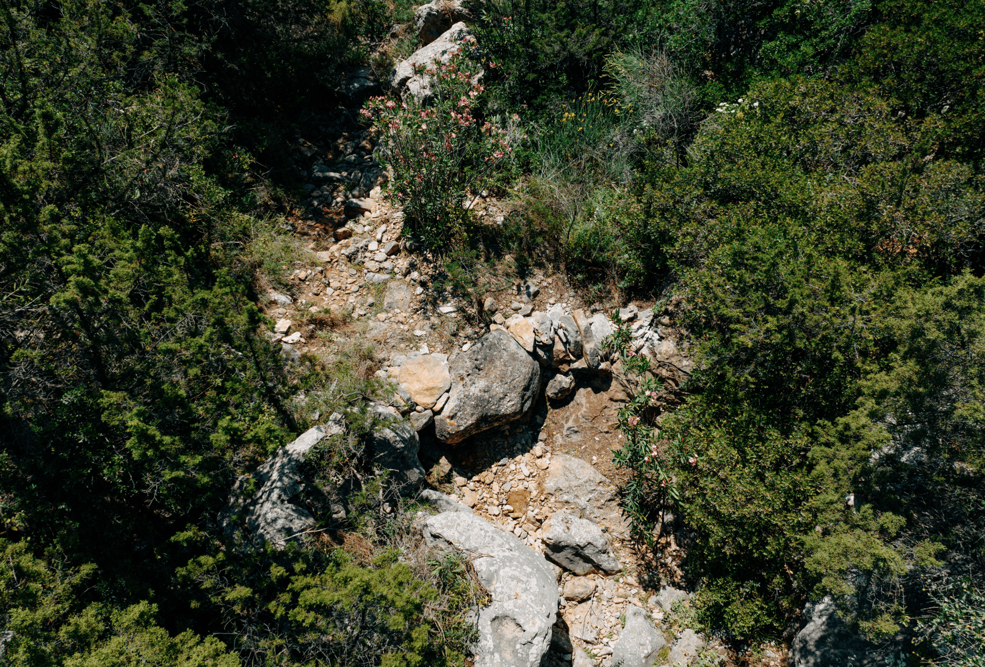
High in the hills above Kamares, the main port village of Sifnos in the Cyclades, 120 traditional dry-stone check dams have been built across two stream networks as part of the CARDIMED project. The construction work was carried out by MedINA (Mediterranean Institute for Nature and Anthropos), with researchers from ICCS (Institute of Communication and Computer Systems) bringing in satellite and sensor-based monitoring to track how well the structures are actually working.
The check dams are low stone barriers built to slow down water during heavy rain — reducing erosion, helping water seep back into the ground, and creating small pockets of habitat for wildlife. Every stone was placed by hand, sourced from the streambed itself, using the same techniques that farmers and herders on these islands have relied on for generations. The result sits lightly in the landscape, and that is very much the point.
Spread across roughly 3.9 km of streambed, the dams are also providing some much-needed protection to the wider Kamares area, which has seen serious flash flooding in recent years.
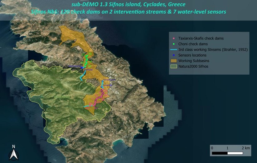
The Sifnos NbS intervention area showing the locations of 120 check dams (Taxiarxis-Skafis and Choni streams) along with sensor locations, working subbasins, and the Natura 2000 boundary. The structures protect the Kamares area, including the island’s main port, from flash flooding.
Measuring Impact from Space
Proving that a Nature-Based Solution is actually working; not just in theory, but in the field; has always been a challenge. Ground sensors and field surveys are useful, but they are expensive to maintain and hard to scale. That’s where satellite imagery comes in. ICCS researchers are using imagery from Sentinel-2 and PlanetScope alongside in-situ sensors and community observations to track how the landscape changes before and after rainfall events — looking at things like vegetation health, surface water, and soil moisture.
The PlanetScope data comes through the Copernicus Contributing Missions programme and offers particularly fine spatial and temporal detail — fine enough to pick up the small, localised hydrological signals that a single stone dam produces, which would simply be invisible in coarser imagery.
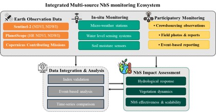
The integrated monitoring framework combines Earth Observation data (Sentinel-2, PlanetScope), in-situ sensors (weather stations, water-level gauges, soil moisture probes), and participatory crowdsourcing to assess NbS performance at multiple scales.
What the Data Shows
Early results are encouraging. After rainfall events, the areas around the stone weirs are holding onto surface water longer than before; a sign that the dams are doing their job of slowing runoff and allowing water to soak into the ground rather than rushing straight downhill.
The satellite data also shows that vegetation recovery seems to track closely with how much moisture has built up in the soil over time, which points to the dams working as a kind of slow-release water store for the surrounding landscape.
The high-resolution PlanetScope imagery has been especially valuable for picking up these localised changes; the kind of subtle, ground-level responses that would otherwise go unnoticed.
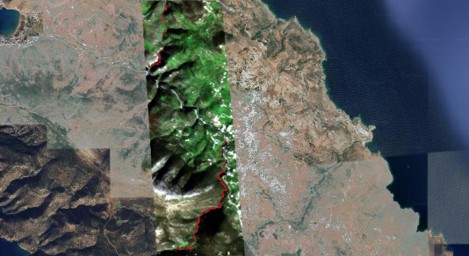
PlanetScope satellite imagery of the Sifnos intervention area (3 m resolution). The red points mark the locations of the 120 stone weirs across both monitored streams. High-resolution imagery is essential for detecting the small-scale hydrological signals produced by individual check dams.
These findings were presented at the EGU General Assembly 2026 (Kossieris et al.: Assessing Nature-Based Solutions for Water Resilience Using Sentinel-2 and PlanetScope Imagery: Traditional Stone Weirs in Sifnos Island (Greece), EGU General Assembly 2026, Vienna, Austria, 3–8 May 2026, EGU26-9282, https://doi.org/10.5194/egusphere-egu26-9282, 2026.) and are being submitted to the River Flow 2026 international conference on fluvial hydraulics.
From Sifnos to Rural Europe: The NURISH Connection
What’s been developed on Sifnos isn’t just relevant to Aegean islands. The monitoring approach is designed to be adaptable, the same combination of satellites, sensors, and community input could be applied to nature-based interventions in rural areas across Europe facing similar climate pressures.
This work feeds directly into the NURISH project, where ICCS leads on digital tools and climate resilience monitoring. The methodology being refined in Sifnos is exactly the kind of evidence-based approach that NURISH aims to bring to rural communities navigating climate adaptation.
Sifnos shows what becomes possible when old knowledge and new tools are pointed at the same problem. The stone weirs have been part of this landscape for centuries. The satellites are new. But together, they’re helping island communities understand, and adapt to, a changing climate in a way that feels genuinely their own.